
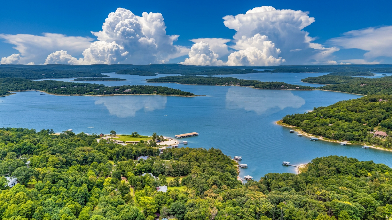
TL;DR: Beaver Lake covers approximately 27,900 surface acres with roughly 449 miles of shoreline at conservation pool, per a 2018 USGS bathymetric survey (USGS, 2018).
Beaver Lake Dimensions and Management
Beaver Lake covers approximately 27,900 surface acres with roughly 449 miles of shoreline at conservation pool, per a 2018 USGS bathymetric survey (USGS, 2018). This substantial expanse of water defines the geography for those who Discover Rogers, Arkansas, creating a distinct backdrop for real estate valuation and lifestyle considerations. The physical scale of the reservoir directly influences inventory availability and the specific characteristics of lakefront properties in the region.
Operational oversight of the reservoir falls under the jurisdiction of the U.S. Army Corps of Engineers, Little Rock District (USACE, 2026). This federal management dictates the long-term maintenance of the shoreline and the rules governing private docks, which are critical factors for any potential buyer assessing the usability of a specific tract. Understanding the regulatory environment is as essential as evaluating the physical acreage when determining property value.
Current water levels impact immediate access and the visual presentation of the shoreline. The conservation pool elevation is 1,120 feet; the lake stood at 1,118.6 feet as of August 11, 2026, about 1.4 feet below conservation pool (USACE Little Rock District, August 11, 2026). A reading below this standard elevation can temporarily affect boat launch capabilities and the proximity of the water to permanent structures, necessitating a review of the latest data prior to any site visit or closing.
Rogers Access To Beaver Lake Recreation
Access to Beaver Lake for Rogers residents is defined by specific infrastructure constraints and designated public areas managed by the U.S. Army Corps of Engineers. The U.S. Army Corps of Engineers stopped accepting new private dock and marina boat-slip requests at Beaver Lake effective July 1, 2020, after the lake reached its carrying capacity for that infrastructure (USACE Little Rock District, effective July 1, 2020). This policy creates a fixed supply of private mooring options, meaning that properties with existing grandfathered dock permits or access to public ramps hold distinct value. Buyers evaluating featured listings near the water should verify whether a property includes established water access, as new permits are not available.
Public recreation remains concentrated in developed parks offering specific amenities. Prairie Creek Recreation Area, at 9300 North Park Road in Rogers, is managed by the U.S. Army Corps of Engineers and has a five-lane boat ramp and a campground with fire rings, picnic areas, and water and flush-toilet facilities (Recreation.gov, 2026 listing). This location serves as a primary launch point for the area. Other USACE Beaver Lake recreation areas in the Rogers area include Rocky Branch and Horseshoe Bend Recreation Area & Campground; designated swim areas include Lost Bridge, Horseshoe Bend, and War Eagle (USACE Little Rock District / Recreation.gov, 2026). These designated zones provide the only authorized swimming and camping access points managed by the federal government in this region.
Fishing, Parks, and Islands Near Rogers
Beaver Lake defines the outdoor lifestyle available to Rogers residents, offering specific aquatic and terrestrial amenities. For those interested in angling, the lake supports largemouth bass, smallmouth bass, striped bass, walleye, crappie, and channel catfish, and is nationally known for bass fishing tournaments according to Arkansas Game and Fish Commission and regional fishing reports from 2026. This reputation for diverse sport fishing adds a layer of value to properties with water access, a factor we consider when you list your home with us. On land, Hobbs State Park-Conservation Area covers 12,056 acres and borders Beaver Lake's southern shore, jointly managed by Arkansas State Parks, the Arkansas Natural Heritage Commission, and the Arkansas Game and Fish Commission as of 2026. This extensive protected area ensures that the natural environment adjacent to the lake remains preserved for long-term recreation.
Water-based navigation from Rogers is facilitated by distinct geographic landmarks. Bear Island and Deer Island are named islands on Beaver Lake and a recognized kayak-trip destination reachable from Prairie Creek Recreation Area, per the official Rogers, AR destination-marketing site (Destination Rogers, 25 Things to Do in Rogers -- Play Beaver Lake, 2026). These specific destinations provide concrete paddling routes for residents. Access to these varied resources—from the tournament-caliber fisheries to the protected state park lands—creates a comprehensive recreational environment that directly influences the desirability of real estate in the Rogers area.
Water Supply And Rogers Real Estate Context
Beaver Lake serves as the primary water source for the region, with the Beaver Water District drawing from the reservoir to supply drinking water to more than 500,000 people across Northwest Arkansas, including Rogers, Bentonville, Springdale, and Fayetteville (Beaver Water District, 2026). This extensive infrastructure supports the daily operations and long-term growth of the area. For a homeowner, proximity to this resource ensures consistent utility service, while the lake's role as a regional asset underscores the stability of the surrounding environment. The presence of a managed, high-capacity water district is a fundamental component of the local municipal framework that supports residential development.
The Rogers median home sale price was $442,500 as of July 2026, with 246 homes sold that month (Houzeo, July 2026). This figure represents the statistical midpoint of transactions, offering a factual reference point for buyers assessing affordability and sellers positioning their listings. Understanding this specific pricing context helps market participants gauge current value without relying on generalized trends. The volume of closed sales indicates active liquidity in the market, demonstrating that properties are changing hands at a measurable pace during this period.
Working With Mason Capital Group in Rogers
Acquiring real estate near Beaver Lake requires a precise understanding of local inventory and valuation trends. Mason Capital Group brings 30+ years in Northwest Arkansas to this process, backed by $2.4B+ in cumulative transaction activity. This depth of experience allows us to provide the specific market data necessary to navigate the Rogers area effectively. For those utilizing this Beaver Lake Rogers Arkansas recreation guide to plan a lifestyle move, our team offers the analytical rigor required to align property acquisition with long-term objectives.
We are located at 609 SW 8th Street, 6th Floor, Bentonville, AR 72712, and can be reached at 479-925-3333 to discuss your requirements. Our approach focuses on portfolio-manager positioning rather than salesmanship, ensuring you receive a clear assessment of how the market actually works. We invite you to contact us to review your strategy for waterfront or proximate properties in the region.
How big is Beaver Lake?
Beaver Lake covers approximately 27,900 surface acres with roughly 449 miles of shoreline at conservation pool, per a 2018 USGS bathymetric survey (USGS, 2018).
Can you build a private dock on Beaver Lake?
No, the U.S. Army Corps of Engineers stopped accepting new private dock and marina boat-slip requests at Beaver Lake effective July 1, 2020, after the lake reached its carrying capacity for that infrastructure (USACE Little Rock District, effective July 1, 2020).
What is the water level of Beaver Lake right now?
The lake stood at 1,118.6 feet as of August 11, 2026, about 1.4 feet below conservation pool (USACE Little Rock District, August 11, 2026).
Where can you launch a boat near Rogers?
Prairie Creek Recreation Area, at 9300 North Park Road in Rogers, is managed by the U.S. Army Corps of Engineers and has a five-lane boat ramp (Recreation.gov, 2026 listing).
What fish are in Beaver Lake?
Beaver Lake supports largemouth bass, smallmouth bass, striped bass, walleye, crappie, and channel catfish, and is nationally known for bass fishing tournaments (Arkansas Game and Fish Commission / regional fishing reports, 2026).